Piksel Explorer
How can we know exactly where and when data is available? Before starting any analysis, we can answer this question by inspecting the data at Piksel Metadata Explorer.
Open the Metadata Explorer
In This Guide
Map or Explorer
Piksel Metadata Explorer and Piksel Maps look similar, but they are designed for different purposes.
Use Piksel Maps if:
- You want to view and interact with a product or dataset in a map viewer.
Use Piksel Metadata Explorer if:
- You want to know exactly where and when you can find the data.
Open Piksel Explorer
Go to https://explorer.staging.piksel.big.go.id/products. This will display the Metadata Explorer user interface.
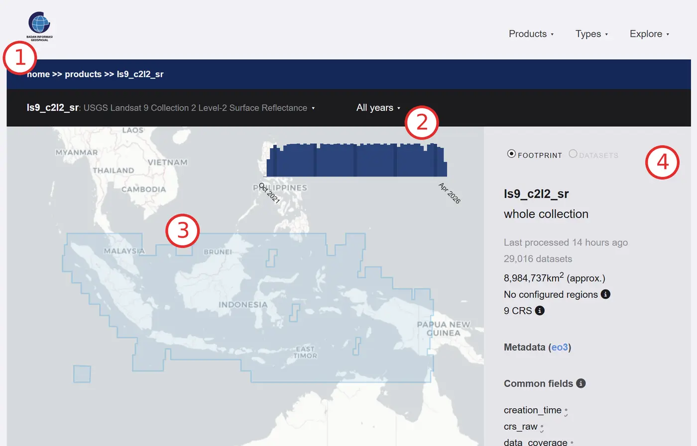
Piksel Explorer has four main sections:
-
Product selection: This section shows the currently selected product. Click the selected product name to open the product menu.
-
Time period: This section shows the time period used to display the selected product. Click the selected time period on the grey menu bar to open the time selection menu. The blue bar chart shows data availability over time for your selected product.
-
Map view: This displays the location of data availability for the selected time period and product. Blue-coloured tiles indicate the presence of data.
-
Product information: The sidebar displays further information about the data for the selected time period and product — including the number of selected datasets, total area, and coordinate reference system.
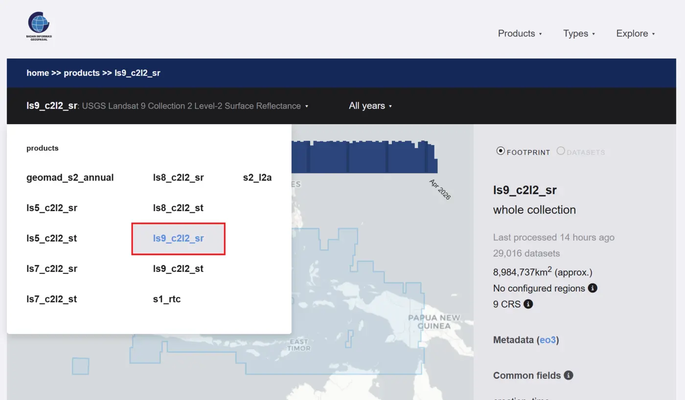
Select Landsat 9 Product
- Click the product selection bar to open the menu. Select ls9_c2l2_sr. This will select the Landsat 9 product.
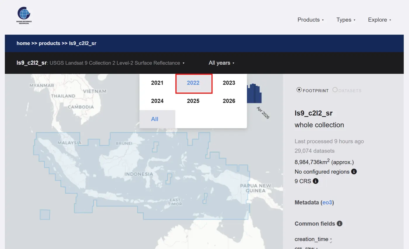
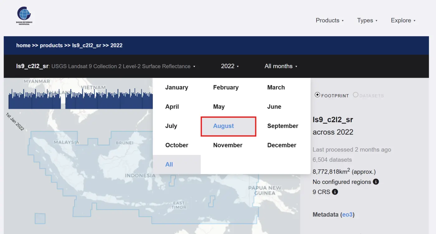
- Click the time bar to open the menu. Select 2022. This will display all Landsat 9 datasets for the year 2022.
- Click the all months bar to open the menu. Select August. This will display all Landsat 9 datasets for August 2022.
- Click the all days bar to open the menu. Select 11. This will display all Landsat 9 datasets for 11 August 2022.
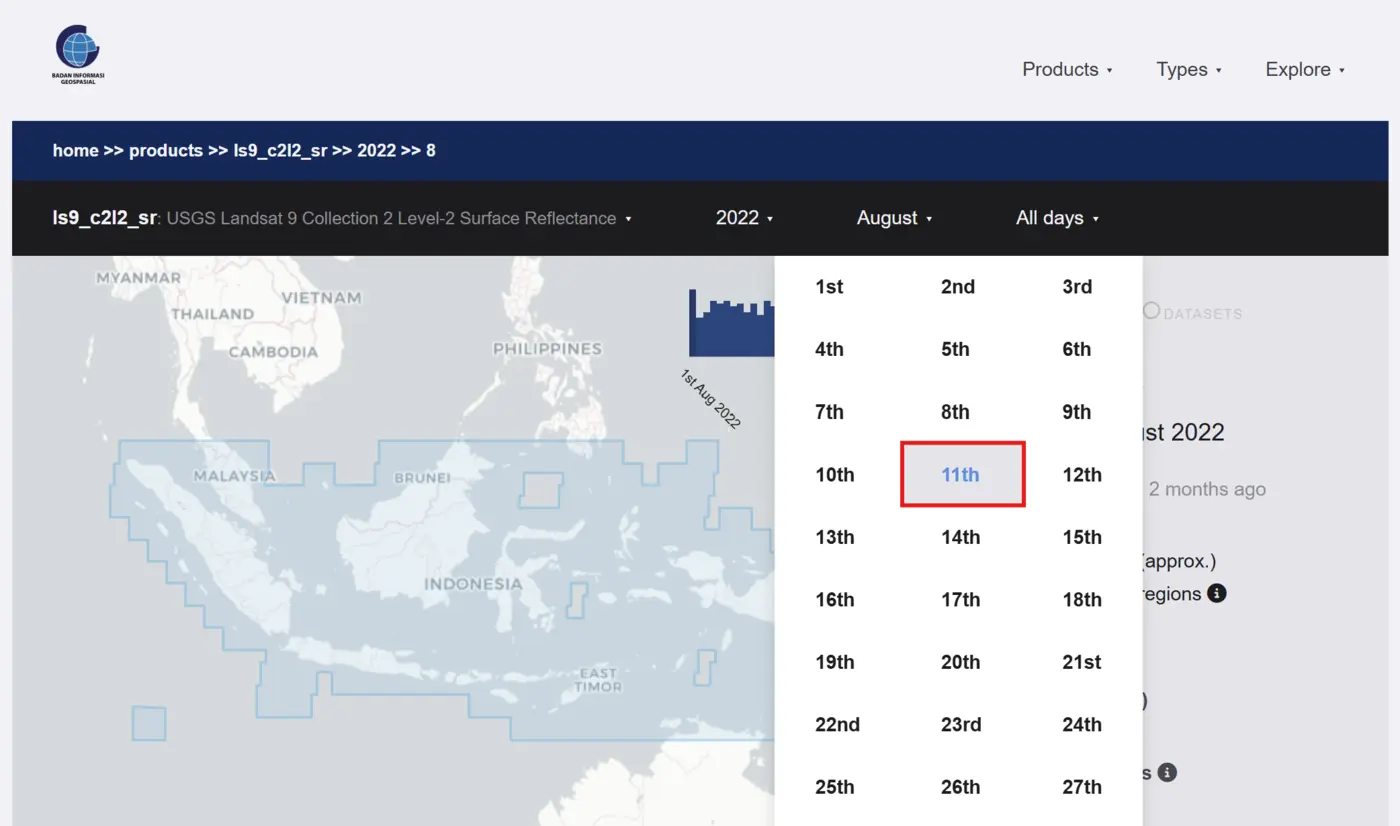
- The map view will now show all Landsat 9 datasets for 11 August 2022 as blue boxes. Use the + button on the map to zoom in, then click and drag to pan.
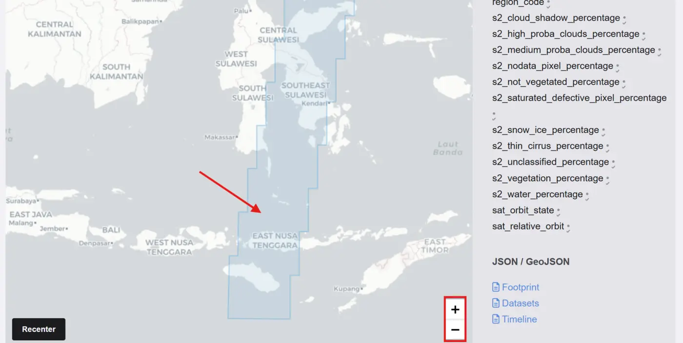
Zoom in on East Nusa Tenggara
Use the + button on the map to zoom into the East Nusa Tenggara region.
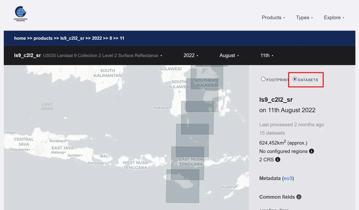
When we hover over East Nusa Tenggara, we can see there is one dataset for that area on 11 August 2022. Click the dataset on the map. You can now see a preview of the data for that tile, along with all the associated metadata below the map view.